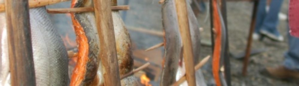
Eutrophication is a problem throughout Puget Sound and specifically in Budd Inlet it has led to problems including low DO. Bioextraction is a method of removing nitrogen through harvesting shellfish and seaweed. Mussel harvesting is a method of “recycling” these excess nutrients. PSI has been investigating this method for use in Puget Sound. In 2011 a pilot project in Quartermaster harbor was found to have success. A project in Budd inlet was subsequently launched in 2013. Monthly data was collected at three sites. By mid July 2013 a good mussel set was found on the sampling straps. TESC was involved in composting the mussels that had grown on the setting straps. 4500 pounds were composted by TESC. New composting collaborations with WDOC-Cedar Creek composting has begun. Compost testing resulted in high calcium content, and grew vegetables successfully. Results indicate that 8000 lbs. of mussels = A removal of 80 Lbs. of nitrogen, or 0.66 lbs. per day. In order to remove 100 lbs. of nitrogen per day, 16,810 straps would need to be installed (compared to the pilot study of 120 straps). This would equal the size of 2 West Bay Marinas. In addition to the quantitative data and feasibility of this mediation process, this project served as a great way to educate the public through youth community involvement about nutrient systems and what they can do on a daily basis to help improve water quality.
South Sound Water Quality- humans and climate and oceans, oh my!
Patterns of dissolved oxygen in South Sound:
At depth, oxygen levels follow seasonal patterns, and they are lowest at this time of year. Shallow inlet oxygen patterns are much more complex. Water stagnates during neap tides, and dissolved oxygen can be lower then.
Mindy Roberts does water quality modeling for Department of Ecology. She is sorting out human versus natural drivers on oxygen levels in South Sound, especially nitrogen sources. Marine sources are more influential than rivers. Examples of human influences are wastewater treatment, leaky septic systems, runoff developed areas… Ocean conditions are changing as well.
Our population will increase significantly in the future. South Puget sound is at the end of along conveyor belt of circulation in South Sound. It is very sensitive to increases in human pressures.
Every inlet of Puget Sound has a unique pattern of circulation and oxygen pattern, a unique response to changing conditions.
This is a long term modeling effort. Mindy and her colleagues are looking right now at how to reduce nutrient inputs that affect dissolved oxygen.
North Sound influences South Sound.
Shore Friendly: Reducing shoreline armor, parcel and owner characteristics
Heather Trim;
WDFW and EPA joined together to conduct a study collecting shoreline armouring data, parcel data, and owner surveys Sound wide.
The teams goal was to create social marketing behavior change strategy that will lead to residential landowners changing their shoreline armoring-related behaviors.
Social marketing is intended to increase motivators and decrease barriers. Some barriers with leaving shoreline unarmored include land owners property not protected from erosion or property not being protected after removal or existing armoring. Some motivators include providing healthy habitat for fish and wild life as well as getting a tax break and reducing fees to land owners.
Their findings include 57% of sound wide parcels are residential parcels, most residential parcels have shoreline armouring Thurston and Mason is the largest forage fish spawning areas that are armoured. 46% of these residential areas are unoccupied parcels. In other words the parcels that are effecting the forage fish spawning areas are mostly uninhabited by home owners.
They also looked at parcel size, land value, and age or owners. Heather found that if the parcel size is larger it is also less likely to be armoured.
Fish Consumption: What’s all the fuss?
Jeff Dickison, assistant natural resources manager, Squaxin Island Tribe.
Catherine O’Neill, Seattle University Law School
Paraphrasing what Catherine is saying:
We know we live in an mazing place, but the fish that we depend on are degraded and are polluted.
Water quality standards are the mechanism for reducing pollution and reducing pollution impact on humans.
Fish consumption rate is a portion of a larger health based equation that is meant to reduce the risk of ill health.
The current FCR is based on an estimate that was done 40 years ago at the request of the tuna industry. Because of pollution, fish consumption was probably pretty low. This is also a time when tribal fishing was still coming back online, the Boldt decision just having been handed down.
Water will only be clean enough to allow up to one meal a month.
Dickson:
The tribe conducted one of the first fish consumption surveys with their members, working with the Tulalip Tribes and the EPA.
The 6.5 rate was built taking into consideration of what people eat in Nebraska. Even coastal people eat more than that. And, tribal members eat even more. Tribal survey was in 1994, 20 years after the original survey.
When you talk about percentiles of protection in Indian Country (90th, 95th) tribal leaders know who the 10 percent and 5 percent who are being left out. It isn’t just a number. So, even rates like 175 are compromise numbers for the tribe, because they leave so many people out.
Squaxin dietary surveys found that children under six consumed fish over 3 times the rate of their parents.
Tribes started proving their populations were at risk 20 years ago, but we’re still not where we need to be. The FCR has not gone up.
O’Neill:
EPA was moved by the tribal studies, updated guidance in 2000:
- National default moved to 17.5 grams a day.
- Subsistence rate moved to 142.2 grams a day
Default rates are only used as a last resource. Local data is preferred. And, Washington of course has local data.
Also, keep in mind that contemporary numbers are lower than historic rates because of pollution and degradation of natural resources.
So, where is Washington? Fifteen years ago, the state recognized they needed to update the FCR, but a report was never finalized.
State started the process, but in July 2012, the state pivoted in their process: http://www.invw.org/article/how-boeing-allies-torpedo-1353
And, lastly, this past summer, the state announced an increase in the FCR to 175, but increased the risk of cancer rate by 10 fold. The state also announced that for the pollutants that would go up, that they wouldn’t backslide.
Live blogging the South Sound Science Symposium tomorrow
We’ll be using this blog tomorrow to cover the South Sound Science Symposium.
Throughout the day, there will be regular updates from the symposium being held at the Squaxin Island Tribe’s Little Creek Events Center. All of the posts will be under this category. You can also follow the social media hashtag (on Facebook or Twitter) #S42014 for even more discussion.
You can find the list of speakers at the symposium here.
Pacific Northwest Climate Science Conference; Linking science and decision making
Attending this conference was nothing short of enlightening and informative. I was honored to be in the presence of over 250 climate change specialists and researchers from all around the region.
Presenters discussed everything from climate change adaptation to mitigation planning. Our main task was to review scientific results, challenges, and solutions related to the impacts of climate change on first peoples, natural resources, and infrastructure in the Pacific Northwest.
Following the presentations was an inspirational speech given by Washington State Governor Jay Inslee about increasing resilience in the Pacific Northwest (PNW).
What is causing the climate to change? It is mostly human consumption of fossil fuels. Eighty four percent of the world’s energy comes from fossil fuels. Fossil fuel usage is one of the largest contributors to global warming. The use of fossil fuels increases our carbon dioxide emissions or carbon footprint. We have dumped more than 1.325 trillion tons of carbon dioxide into the atmosphere. The path that we are on will lead to a 5-50 inch increase in sea level and approximately a four degrees Celsius warmer world by the end of the century. Imagine what a 5-50in rise in sea level could do to our shorelines. Though I was aware of the many consequences that the over use of fossil fuels has on our planet, I had no idea that I would see the impacts in my lifetime. For example, the picture below is downtown Olympia in the year 2100 if we do nothing to mitigate climate change.

(The dark blue indicates sea level rise)
Why plan and prepare for impacts of climate change? First our tribal communities, culture, employment, and way of life is all connected to our first foods. Our traditions and ceremonies depend on healthy salmon runs as well as shellfish harvesting. Sea level rise caused by climate change could cause our first foods to no longer be available to our people. Second our treaties and regulations only serve our community if there are salmon and shellfish to harvest. For instance, temperature increases between one and five degrees Fahrenheit could cause our cedar trees to be found in new locations, likely outside our usually and accustom treaty grounds. If trees like the red cedar are no longer found in their traditional locations at optimal harvesting times how will we teach the next generation to weave? Developing a plan of action now is key to preserving our community’s way of life.
Report Derelict Gear
What is derelict gear?
Derelict fishing gear includes fishing nets, lines, crab and shrimp traps or other equipment that is abandoned or lost in the marine environment. Derelict fishing gear is long-lasting marine debris that poses many problems to people and to marine animals, including: Entangling divers and swimmers; Trapping and wounding or killing fish, shellfish, birds and marine mammals; Degrading marine ecosystems and sensitive habitats; Damaging propellers and rudders of recreational boats, commercial and military vessels.

Entangled Red Rock Crab
As of March 31, 2014, the Northwest Straits Initiative has removed 4,702 derelict fishing nets, 3,265 crab pots, and 47 shrimp pots from Puget Sound, restoring 672.3 acres of critical marine habitat.
You Tube Video- KCTS9-Puget Sound Matters:Derelict Gear
There are three easy ways to reporting derelict gear and no penalties associated with reporting lost fishing gear:
Report loss net gear within 24 hours of loss.
Online Derelict Fishing Gear Reporting Form: http://www.derelictgeardb.org/reportgear.aspx
Report Derelict Gear call: 360-733-1725 (Northwest Straits Initiative)
Report Derelict Gear Reporting Hotline: 1-855-542-3935 (WDFW)
It is important that our tribal fishermen do their part in reporting lost fishing gear.

Recovered derelict gill net
Squaxin Island Tribe, land trust, turning golf course into habitat

Bayshore on Oakland Bay. Photo by the state Department of Ecology.
The Capital Land Trust and the Squaxin Island Tribe are working to bring back salmon habitat and protect an important shellfish growing area by restoring a former golf course on Oakland Bay. The land trust recently purchased the 74-acre Bayshore Golf Course, which includes the mouth of Johns Creek and over a thousand feet of Oakland Bay shoreline.
The tribe and the land trust will remove a 1,400 foot dike, restoring the Johns Creek estuary and important marine shoreline. “Taking the dike out will provide salmon with additional acres of saltwater marsh to use as they migrate out to the ocean,” said Jeff Dickison, assistant natural resources director for the tribe..
Eventually, the golf course fairways will also be replanted with native vegetation, restoring a streamside forest that helps provide habitat to salmon.
Preventing development around the bay also protects the most productive shellfish growing area in the state.
The former golf course sits on a peninsula jutting into Oakland Bay that is made up of mostly gravelly glacial outwash. “If the golf course had been sold to developers, the porous nature of the gravel underneath the golf course couldn’t have protected shellfish beds from being polluted by septic tanks,” Dickison said.
The mouth of Johns Creek was the site of one of the largest longhouses and Squaxin villages. “We have always thought of this place as special,” said Andy Whitener, natural resources director for the tribe. “Our people lived there for thousands of years, subsisting on the fish, shellfish and wildlife that was always available.”
The state Department of Ecology also helped the land trust buy the surface water rights associated with the golf course. “Johns Creek doesn’t have enough water to support a weak run of summer chum,” said Scott Stelzner, salmon biologist for the tribe. “By securing this water right, we can balance against increased water appropriations throughout the Johns Creek watershed.
The restoration of the old golf course is part of a larger effort to protect and restore Oakland Bay. The tribe, the land trust and other local partners have protected hundreds of acres of habitat and improved water quality throughout the bay.
“It is important to make sure we protect places like Oakland Bay, before they turn the corner and can’t be saved,” Dickison said. Currently, Oakland Bay is relatively undeveloped, but that could easily change in the next few years.
“The decline of salmon and shellfish directly impacts our culture, economy and our treaty reserved rights,” Whitener said. “Making sure Oakland Bay is healthy is one of the most important things we can do to protect our way of life.”
Where Water Flows Underground

This photo is from the LOTT reclaimed water website. http://www.lottcleanwater.org/reclaimed.htm
The LOTT Clean Water Alliance in Olympia is at the intersection many serious water issues in our region.
- The Thurston County population continues to grow and therefore produce more wastewater.
- For the health of South Puget Sound, LOTT is limited in how much wastewater it can discharge to Budd Inlet.
- In order to avoid discharging treated wastewater into Budd Inlet, LOTT treats wastewater to almost drinkable quality (“Reclaimed Water”), and infiltrates it into the ground at a site up near Hawks Prairie.
- A growing population requires adequate sources of water for drinking and many other uses.
- Most basins in Thurston County are closed to new water rights, and some streamflows are low compared to historical levels.
- Groundwater is connected to surface water.
Once reclaimed water infiltrates into the Hawks Prairie site and to two other proposed new sites, it will move with groundwater and into the vicinity of drinking water wells. Reclaimed water will be treated as it moves underground, and it will eventually find its way to nearby streams and to the Deschutes River. This could be very beneficial for augmenting stream and river flows. However some residual chemicals may remain in reclaimed water. These chemicals would come from household products like medicines, shampoos, and cleaning products. Imagine you are a fish swimming in the Deschutes River. You could be swimming in the last traces of ibuprofen, Mr. Clean, and Dial soap left in LOTT’s reclaimed water. Imagine pouring water from your tap. Though drinkable, it could have the smallest trace of other people’s antibiotic prescriptions, bathroom cleaner, and Head and Shoulders. These chemicals may already be in groundwater and surface water, because thousands of septic tanks are in the ground in Thurston County. Septic tank waste is not nearly as thoroughly treated as reclaimed water, but it too will eventually connect to groundwater.
Reclaimed water could be a very good tool for water conservation, but it is a new tool in Thurston County. LOTT is currently planning a study to determine if residual chemicals remain in reclaimed water as it moves through groundwater and eventually to streams. You can find a link to the study plan at http://www.lottcleanwater.org/pdf/groundwater.pdf. As a representative of the Tribe, I sit on the science task force for the reclaimed water infiltration study. The role of the science task force and also a community advisory group and independent peer review team is to provide input on the planning and implementation of the study.
To support the tribe’s treaty reserved right to harvest, salmon need good spawning habitat and an adequate supply of clean water. In some streams, there is not enough water. LOTT’s reclaimed water may help increase flows, but the chemical content of that water when it reaches streams is unknown. Also unknown are the potential effects on animals and plants in the water and on humans. The results of this study will turn those unknowns into solid information and answers.
Week 46 South Sound Fall Chum Test Fishery at Apple Cove
Thursday November 14th, 2013 was the final day of test fishing for South Sound fall chum at Apple Cove Point. They got a bit of a late start after some mechanical problems with the skiff, but eventually managed to get in 5 sets. Catches were low, as might be expected for week 46. They caught 143 chum (plus 2 coho and 3 immature Chinook) in 5 sets, for a catch-per-set of just 29 chum.
They also had a sea lion active in the seine during at least two of the sets (including the day’s biggest set). The proportion of females was about the same as last week, 58%. The age distribution for the catch was 3 year old at 34.5%, 4 year old at 63.8%, and 5 year old at 1.7%.
Watch this video of the South Sound Fall Chum Test Fishery at Apple Cove :
WDFW had purse seine openings on Monday (11-11-2013) and Wednesday (11-13-2013) and caught a total of 72K chum with 84 purse seine landings. Both days the fleet was split pretty evenly between areas 10 and 11. On Monday 11-11-2013 the larger catches were in area 11 but Wednesday 11-13-2013 they were pretty much equal. WDFW had observers out on the boats during Wednesday’s fishery and the largest set they saw was for 500 fish in area 11. WDFW observed 9 sets is area 10 of which 3 were about 200 fish, 5 were for 50-100 fish and 1 was a water haul. WDFW commercial chum catch to date was estimated to be at 225K.
Apple Cove Test fishery ISU models ranged from 543K to 637K. The ISU models using WDFW purse seine catch data are a bit higher than the Test Fishery’s. They range from 652-720K. Regional catches for Tribes appeared to decline through out the Puget Sound with the exception of Squaxin Island Tribe. Puyallup reported that there are very few chum returning to the river. Winter chum are beginning to show up in the Nisqually. Current catch for Squaxin Island Tribe as of November 16th is at 67, 071 chum.
Week 46 Puget Sound Fall Chum Runsize was updated to 550K, down from last weeks update of 600k.
Totten Inlet and Skookum Inlet are at escapement. The last Kennedy Creek stream survey on November 14th resulted in 11,890 live and 1,882 dead. We are seeing a good number of chum in Eld Inlet as well as in Perry, McLane, and Swift creeks. Eld is well on its way to escapement.