Brownfield Cleanup sites

Squaxin is checking initial federal and state database screenings for sites on the reservation that are potential brownfield sites.  Those include underground storage tanks that may already be decommissioned, illegal garbage dumps that have partial records of cleanup.  Outside the reservation, we are meeting with WA State Dept. of Ecology to discuss their cleanup progress on existing sites.

Click Here for >>>>Squaxin Tribe Clean Up Sites

The total Number of Brownfield sites is as follows, Development of the initial list of contaminated or potentially contaminated sites began with downloading Ecology’s database of all 180,704 Facilities and Sites of Environmental Interest in the State. This database contains information for sites within the State for which a permit or permit related report, notice, or violation has been issued. This database was clipped to include only those entries within the SITs U&A; this resulted in a total of 6,163 entries.

Data from the State Brownfields program and the U.S. Environmental Protection Agency (EPA) Brownfields sites list were also downloaded and cross-checked against the initial download. Four sites were listed in the State Brownfields Program and seven were listed in the federal list, but there was some overlap with sites already listed in Ecology’s database. After reviewing all of the Brownfield’s sites, a total of four new sites were identified and added to the master database for a revised total of 6,167 entries.

Since the master database includes a wide variety of sites of possible interest to Ecology (e.g., a wetland mitigation site, a site covered by an NPDES permit, and a dam site) most of them were not of interest to this inventory. The Interaction Type Code (ITC) indicates which Ecology program the site is connected to and therefore indirectly reflects the reason for Ecology’s interest in the site. There were a total of 86 ITCs in the master database that Herrera reviewed to screen the list. Most of these were eliminated because they are not related to contaminated or potentially contaminated sites, which resulted in approximately 1,500 entries in the master database.

The next step was to consider the ‘site status’. Site’s with the following status were also eliminated from the database:

  • Construction Complete-Performance Monitoring
  • No Further Action

After meeting with Ecology final changes were made to the inventory, resulting in a complete inventory of 234 sites. This inventory still includes multiple listings for some sites, which will be further evaluated under Phase 3. The database reflecting these sites was submitted to the SIT. Figure 1 depicts the locations of all of these sites within the SIT U&A.

The highest priority areas for the SIT are those near Oakland Bay and Budd Inlet and near areas currently or potentially used for shellfish harvest. These areas are shown in Figure 2. There are 145 sites identified within 1/4 mile of these high priority areas. These attributes were added to the inventory database to allow easy sorting.


Squaxin Tribes Brownfield Public Record

Some considerations for Brownfield site prioritization include:

  • Should sites classified as Cleanup Started sites rank higher than Awaiting Cleanup, because there is already momentum and an identified site owner?
  • What sites have the highest risk pollutants, and are they mobile in water?
  • Which sites may cause immediate health risk to aquatic species?
  • Which sites are located over critical aquifer recharge areas or immediately on shellfish beaches?
  • Eliminate certain sites as highest priority because of our existing knowledge of them for example duplicate sites with the same address.
  • Develop a criteria appropriate to use for further ranking all of the remaining sites.
  • Draft criteria appropriate for selecting the top 10 to 15 sites.
  • Initiate communication with the City of Shelton and with the City of Olympia to discuss the cities’ priorities for cleanup (since there are so many contaminated sites in both of these downtown areas.)

Squaxin Tribe Brownfield Public Record

If there is a problem with the website features the Squaxin Public Record can be viewed by contacting,


Candace O Penn
Climate Change Ecologist
Squaxin Island Tribe
Natural Resources Dept.
cpenn@squaxin.us
(360) 432-3898


Brownfields Tribal Response Program

Brownfields Tribal Response Program

The Squaxin Brownfields Tribal Response Program (TRP) started in 2018 as an environmental program within the Squaxin Tribe Natural Resources Office. Squaxin Island Tribe receives a yearly grant from the Environmental Protection Agency (EPA) to maintain the program.

What is a brownfields site?
Brownfields sites are abandoned, idled, or underused industrial and commercial properties where development, redevelopment, or expansion is complicated by actual or suspected environmental contamination. By investigating and cleaning up brownfields sites, many of which are abandoned areas that may impose an environmental risk to the local community, development can take place with less concern about legal liabilities related to site contamination. This benefits the Squaxin Island Tribe by bringing jobs to the area, making abandoned property functional, and possibly preserving sites that have historic and cultural significance. For more information about brownfields sites, visit U.S. EPA, Brownfields


PROGRAM OVERVIEW
Timely survey and inventory
  • Establish a system to identify, prioritize, and survey brownfields sites on the Reservation
  • Review databases and other sources of existing information to identify sites
  • Update existing databases with newly assessed brownfields site information
Environmental assessments
  • Conduct assessments on potential brownfields sites by trained staff or by hiring a qualified contractor
  • Estimate costs for cleanup for a site
  • Develop a reuse/redevelopment plan for sites taking into consideration the contamination issues
Public record
  • Update annually, or more often if appropriate
  • Include site locations, responses, and future plans
Public participation
  • Incorporate brownfields information into current public outreach activities
  • Establish procedure for prior notice and opportunity for public comment as well as a mechanism by which an affected person may request a site assessment be conducted
Cleanup
  • Create a draft cleanup and verification plan and implement a review process
  • Design a process by which cleanup plans and efforts can be certified and include procedures, documentation, and a step by step process
Oversight and Enforcement
  • Establish a follow-up inspection protocol to survey any new brownfields sites
  • Research existing environmental oversight and enforcement authorities
  • Develop administrative procedures to assure response actions are conducted in a lawful manner and protect human health and the environment → Learn More

Brownfields sites can potentially include:

  • Abandoned warehouses and industrial properties
  • Old buildings, factories, gas stations
  • Open/illegal dumping (particularly involving hazardous wastes such as gas, oil, pesticides, paints, etc).
  • Drug labs: Materials found at these sites are extremely hazardous; don’t investigate yourself. If you suspect a drug lab in operation or discover a location you suspect might be a former drug lab, call the police immediately.
  • Above-ground or underground fuel storage tanks that are abandoned or suspected to be leaking

A brownfields site is not:

  • A site that the owner is liable for contamination and that is being used as an open dump
  • A site where a removal action or cleanup by another organization or agency has occurred or is occurring

Report a brownsfields site
The Squaxin Island Brownfields TRP can only investigate what it knows about. For this reason, input from the community is crucial. We encourage any information you can provide about potential brownfield sites on the reservation as well comments on sites we are currently working with. Contact the Squaxin Island Department of Natural Resouces with your questions, suggestions, or comments.

Links


Squaxin Island Tribe Request for Qualifications (RFQ)

SQUAXIN ISLAND TRIBE
REQUEST FOR QUALIFICATIONS

SOUTHERN PUGET SOUND WATERSHED PLANNING COORDINATOR

The Squaxin Island Tribe is seeking qualified candidates for a part-time (20 – 24 hours a week) Watershed Planning Coordinator to support the Tribe’s participation on several Watershed Restoration and Enhancement Committees in the South Sound area. For more information contact Jeff Dickison at 360-432-3815. Interested parties should respond by October 19, 2018. Eventual hire may be by a contract for services, or by a hire as a Tribal employee depending on circumstances with the eligible candidate.

ABOUT THE PLANNING PROCESS
The Watershed Restoration and Enhancement Committees are being established by the Washington Department of Ecology under Chapter 90.94 RCW (See Ecology’s website: https://ecology.wa.gov/Water-Shorelines/Water-supply/Streamflow-restoration). These Committees have until June 2021 to develop and approve a watershed plan to offset potential impacts to instream flows associated with permit-exempt domestic water use. The Tribe expects to participate in Committees in WRIAs 12, 13, 14, and 15.

IDEAL CANDIDATE
The ideal candidate will have:
• Experience working with multiple partners and stakeholders, boards, and committees.
• Demonstrated experience with environmental planning and programs, preferably in salmon recovery and hydrology efforts.
• A familiarity with the Watershed Restoration and Enhancement Committee process as laid out in Chapter 90.94 RCW.
• Experience with grant management, reporting, and compliance.
• A strong desire to serve the Tribal interest.

EXPERIENCE
• Five years of experience in environmental planning, outreach, or program coordination.
• Two years of salmon recovery and/or hydrology experience

EDUCATION
A bachelor’s degree in environmental sciences or studies, or related field. A master’s degree is preferred.

THE POSITION
A successful candidate could expect to:
• Represent the Squaxin Island Tribe at Watershed Restoration and Enhancement Committee meetings
• Coordinate with Tribal personnel to identify and rate restoration and conservation opportunities.
• Working with the Committee, develop a work plan to guide the overall effort of creating a prioritized mitigation project list to recommend for funding and implementation.
• Create a ranked habitat mitigation project list and submit it to the appropriate state agencies and boards.
• Document the goals and strategies needed for salmon recovery and hydrological restoration in the WRIA.
• Track salmon restoration and hydrological protection projects in the WRIA areas in the appropriate state database.
• Conduct community outreach and education relating to salmon recovery and streamflow restoration efforts.
• Undertake administrative tasks relating to the role of Watershed Planning Coordinator.

Highly qualified candidates will have the ability to:
• Lead and motivate others.
• Manage multiple projects.
• Problem solve and provide holistic solutions.
• Resolve conflict in an open and inclusive manner.
• Develop and write plans based on an analysis of data and ongoing stakeholder, community, and agency input.
• Communicate effectively (in writing and orally) with individuals and groups.
• Establish and maintain effective working relationships.

COMPENSATION
Hiring range for the position is approximately $2,000 – $2,500 per month on a part time basis for 20 -24 hours per week and depending on qualifications.

TO APPLY
Email application materials to jdickison@squaxin.us or mail or hand deliver to 200 SE Billy Frank Jr Way, Shelton, WA 98584.

To be considered, applicants must submit all the following:
1. Letter of interest that addresses how your education, experience, knowledge, and abilities make you an ideal candidate for the position.
2. Resume.

The most qualified applicants will be invited to take part in an interview process. This position will remain open until filled. Applications will be reviewed beginning October 19, 2018.

A Walk Down Squaxin Islands Climate Change Road

Some of you might be wondering what we as a tribe are doing about climate change? How is Climate Change effecting our first foods like shellfish, salmon, and harvestable plants? As the Climate Change Ecologist Trainee for the Tribe these are things I think about quite often. I have collected various graphs, charts,and images that I hope will resonate with you about what climate change is and how first nations are being affected. You will see two Links below, The first is a short video about indigenous people and climate change. I have also attached a presentation that I presented to our tribal council and I felt as though I left them wanting more information about Climate Change here in the Pacific Northwest. I hope you as well are left wanting more information, I would be happy to email anyone more links and media that illustrate issues related to climate change or just sit down and talk about Climate Change. Stay tuned for my next exciting post about Ocean Acidification!

275340061-Climate-Change-Presention-for-Council-FY15


Youth Fresh Water Mussel Surveys


IMG_0258 - Copy

This picture was taken by Natanya Epstein while at a training in Portland, Oregon hosted by the Xerces Society. The training was for Fresh water mussels protocols and proper survey techniques.

20150713_140337_resized20150713_130905_resized

SIT staff attended this Fresh Water Mussel survey training to prepare for future programs with tribal youth. The pictures above are from a training at Crystal Springs Creek in Portland, OR. Below are pictures from a our tribal youth pilot program at Mill Creek in Shelton, WA. The below pictures are from a pilot youth mussel survey program we started this summer to hopefully get money to fund next year for a tribal youth internship program. If we are awarded the funding we would be able to take tribal youth out to this kind of research again.


20150715_144303_resized 20150715_144400_resizedIMG_2369

IMG_2364


IMG_2371 IMG_2394 IMG_2391


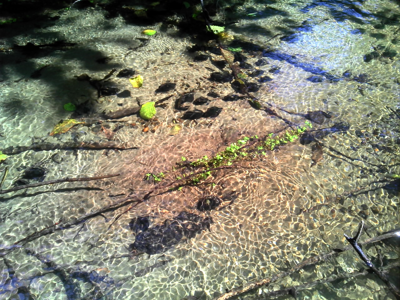
The Squaxin Island Tribal youth are having a great time in these pictures, having fun while also collecting vital data. Our group of youth ranging in ages from 13-20 surveyed Mill Creek in Shelton, WA to identify the presence and/or absence of fresh water mussels as well as stream habitat surveys. They are collecting data on a species that there is very little know about and at the same time introducing tribal youth to the wonderful world of science. The Fresh water mussels species we see most often is the Western Pearshell or Margaritifera falcata Fresh Water Mussel pictured below.


mussel

Western Pearlshell or Margaritifera falcata Fresh Water Mussel

Mussels and Climate Change:

Fresh Water Mussels of the Pacific Northwest Guide Book:

http://www.xerces.org/wpcontent/uploads/2009/06/pnw_mussel_guide_2nd_edition.pdf

Pg.17  [Western freshwater ecosystems have suffered increased levels of alteration and exploitation since settlers first arrived more than 150 years ago. Mussels have been eliminated from portions of rivers and even entire watersheds through the combined effects of habitat loss, pollution, blockage of anadromous fish, and introduced species. The factors that seem to have had the greatest effect on western freshwater mussels include water availability, dams, introduced species, loss of host fish species, and the chronic effects of urbanization, agriculture, and logging on habitat quality. Global climate change will exacerbate the effects of many of these stressors on western ecosystems (see www.epa.gov/climatechange).

There is a critical need for greater research into freshwater mussel biology, distribution, status, and threats. This information is vital for effective conservation of western mussels. Specifically, there is a need to better understand the distribution, habitat, host fish species, life history, population structure, recruitment, and population trends of all western freshwater mussel species. More information is needed to understand the taxonomy of what is currently called the western Anodonta, and whether these animals can be identified by shell morphology. In addition, there is a need to understand how western freshwater mussels are affected by threats to water quality, habitat fragmentation, hydrologic alteration, global climate change, altered water levels, and loss or reduction of host fish. Increasing public and government awareness of the importance of freshwater mussels will contribute to effective conservation of these species in the West.]


Related Studies:

  1. Overlooked Gems: The benefits of Fresh Water Mussels By Al Smith and Sarina Jepsen.

An article from Wings magazine

http://www.xerces.org/wp-content/uploads/2009/01/mussel_article.pdf

A few lines from the study:

{Archeological records show that Native Americans have harvested mussels for at least ten thousand years. Their soft bodies were eaten, and their hard shells were used as spoons and hoes, crushed as temper to strengthen clay when firing pottery, and made into jewelry. The pearls created by some species of freshwater mussels were often strung into necklaces or used decoratively, inlaid as eyes into animal designs. Native Americans were not the only ones who were attracted to these gems. During the second half of the nineteenth century, pearl hunting became a big business, sparked in 1857 by the discovery in New Jersey of a pearl that sold for $2,500 —in excess of $50,000 today! The ensuing clamor for pearls was so intense that entire streams were stripped of their mussels.

To this day, the harvesting of mussels threatens some populations in the southeastern United States. Freshwater mussels remain in demand by the pearl industry, though not for their own pearls but for their shells. Pieces of the thick mussel shells are cut and placed inside marine oysters as seeds to stimulate the formation of oyster pearls. As important as this market has been, however, the greatest mussel-based industry was the manufacture of “pearl” buttons. Johann Boepple pioneered the craft, opening his first factory in Muscatine, Iowa, in 1891. Stamped out of mussel shells, the best buttons came from thick-shelled species such as the yellow sandshell (Lampsilis teres) and pistolgrip (Tritogonia verrucosa). At the time, there appeared to be an endless supply of these shiny, durable shells, and Boepple’s success inspired others to join the industry. According to the University of Tennessee’s Frank H. McClung Museum, by 1912 there were nearly two hundred button factories in the United States. Mussels remained at the heart of the industry until the 1940s, when they were replaced by plastics.}

  1. The Threat of Climate Change to Freshwater Pearl Mussels Populations
  2. http://www.fws.gov/columbiariver/mwg/pdfdocs/Hastie%20paper.pdf

{Changes in climate are occurring around the world and the effects on ecosystems will vary, depending on the extent and nature of these changes. In northern Europe, experts predict that annual rainfall will increase significantly, along with dramatic storm events and flooding in the next 50–100 years. Scotland is a stronghold of the endangered freshwater pearl mussel, Margaritifera margaritifera (L.), and a number of populations may be threatened. For example, large floods have been shown to adversely affect mussels, and although these stochastic events were historically rare, they may now be occurring more often as a result of climate change. Populations may also be affected by a number of other factors, including predicted changes in temperature, sea level, habitat availability, host fish stocks and human activity. In this paper, we explain how climate change may impact M. margaritifera and discuss the general implications for the conservation management of this species.}


Other Related Projects:

Western Freshwater Mussel Database: The Xerces Society and the Confederated Tribes of the Umatilla Indian Reservation have compiled a database of western freshwater mussel records for the following species and clades: Anodonta californiensis/nuttalliana, A. oregonensis/kennerlyi, Gonidea angulata, and Margaritifera falcata.  (Margaritifera falcata: is species we commonly see in our creeks, Mill Skookum and Goldsborough)

Go Inslee!!!


IMG_2183

Sand Lance and Surf Smelt (Forage Fish) Eggs


Governor Inslee signs Forage Fish Bill (SB5166)!

This bill directs WDFW to conduct extensive forage fish spawning surveys throughout Puget Sound over the next two years and will provide significant benefit for improving habitat protections.

Proposed by Sen. Christine Rolfes, D-Bainbridge Island, the bill requires the state Department of Fish & Wildlife and state Department of Natural Resources to team up on an ambitious survey of forage fish spawning areas and a mid-water trawl survey at various depths throughout the sound. The survey results will help Fish and Wildlife develop conservation strategies for small fish populations that appear to be declining.

“The population of forage fish is really important to the recovery of Puget Sound,” Rolfes said. “But we really don’t now how precarious their population is right now.”

The spawning survey will be carried out along shorelines with the assistance of volunteers and military veterans employed by the Washington Conservation Corps.


SENATE BILL 5166

By Senators Rolfes, Ranker, and Hasegawa

Read first time 01/15/15. Referred to Committee on Natural Resources & Parks.

AN ACT Relating to the management of forage fish resources; amending RCW 77.32.010; and creating new sections. (See new sections below)

NEW SECTION.  Sec. 2.  The departments of natural resources and fish and wildlife must collaborate to conduct a survey of the location of surf smelt and sand lance spawning grounds throughout Puget Sound, including the Strait of Juan de Fuca. To the extent available, the departments of natural resources and fish and wildlife must conduct the surveys using crews of the veterans conservation corps created under RCW 43.60A.150. Results from this survey must be used by the departments of natural resources and fish and wildlife to expand knowledge of spawning habitat areas. The survey results must be made accessible to the public.

NEW SECTION.  Sec. 3.  The department of fish and wildlife must conduct a mid-water trawl survey at various depths throughout Puget Sound to evaluate the prevalence of adults of all species of forage fish. The department must integrate the results of the survey into existing Puget Sound ecosystem assessments to assist the department of fish and wildlife in the management and conservation of forage fish species and the species that prey upon them.

The department of fish and wildlife must complete the survey by June 30, 2017.

For more information please visit:

http://search.leg.wa.gov/search.aspx#document

or

http://www.kitsapsun.com/outdoors/governor-signs-bill-for-big-study-of-puget-sound-forage-fish_41060122

Intertidal Forage Fish Training with WDFW, Its an Egg Hunt!

IMG_2185

Phillip Dionne pictured in blue holding the plastic bag

We were lucky enough to have Phillip Dionne from WDFW join us at the Natural Resource Department. He gave a presentation about forage fish and there critical habitat along the shores of Puget Sound. Forage fish lay their eggs in the sand-gravel beach zone as well as the outer tide flats. A substantial amount of forage fish spawning habitat has been lost or destroyed by the high impact of shoreline usage and development in Puget Sound. As you can see below the shoreline is armored and because of the location forage fish spawn it makes them vulnerable to shoreline development and other human actions.

IMG_2188

Example of shoreline armoring and example of forage fish spawning habitat survey

The need for public education about forage fish and their ecological role is constant to maintain a well-informed community. Many people are unaware of just how many species utilize the shoreline; forage fish being a few of them. The term “forage fish” can be broadly applied to many species that are, in many cases, related through ecology and not phylogeny. Pacific herring Clupea pallasii, Northern anchovy Engraulis mordax, Pacific sardine Sardinops sagax, Surf Hypomesus pretiosus, Longfin Spirinchus thaleichthys, Pacific sand lance Ammodytes hexapterus, and Rock sole Pleuronectes bilineatus are just a few species that use the shorelines. For a map of spawning activity please visit, http://wdfw.wa.gov/conservation/research/projects/marine beach spawning/

IMG_2191

Natural Resource Crew watches as Phillip Dionne demonstrates, “The Vortex Method”

IMG_2180 IMG_2177 Phillip Dionne (WDFW) giving a demonstration on laboratory procedures for recovering forage fish eggs

What the Heck is a Fresh Water Mussel?


Photo Courtesy of Marbet, Erika

Photo Courtesy of Marbet, Erica

The average individual could walk through a creek without even noticing these small gems. In fact most people are completely unaware of their existence. Freshwater bivalves are a kind of freshwater molluscs. They are bivalves which live in freshwater, as opposed to saltwater. The majority of species of bivalve molluscs live in the sea, but a number of different families live in freshwater. Fresh water mussels can thrive in many different habitats small ditches, lakes, canals, rivers and creeks. While walking Mill creek with our summer youth program employees we found hundreds of fresh water mussels. The species we found is the Western Pearlshell (shown in all pictures). The Xerces Society is dedicated to developing a variety of publications that educate people on how to identify and conserve fresh water mussels, as well as manage their habitat. “The Society uses advocacy, education, and applied research to defend invertebrates”. For more information about fresh water mussels of the pacific northwest visit, http://www.xerces.org/western-freshwater-mussels/.

photo courtesy of O'Connell, Emmett

photo courtesy of O’Connell, Emmett

photo courtesy of O'Connell, Emmett

photo courtesy of O’Connell, Emmett

photo courtesy of O'Connell, Emmett

Pictured is Rana Brown Shellfish Biologist photo courtesy of O’Connell, Emmett